MDZ507
Current watches, warnings, and advisories for Northwest Harford (MDZ507) MD
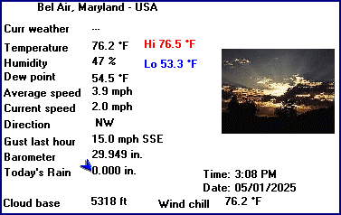
Mark Hofmann's Bel Air, MD - USA (Weather Station)
LAST READING AT TIME: 4:49 PM DATE: July 26 2026, time of next update: 4:50 pm
Current Weather
---
Current Temperature
80.4°F (26.9°C) (Heat Index 82.6°F ), Apparent temp 83.7°F
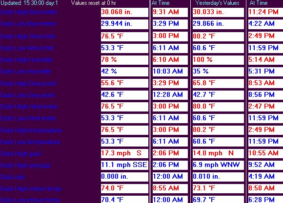
Maximum Temperature (since midnight)
82.0°F at: 3:22 PM
Minimum Temperature (since midnight)
62.3°F at: 5:29 AM
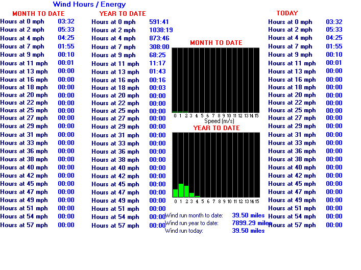
Average windspeed (ten minute)
2.9 mph
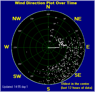
Wind Direction (ten minute)
SSE (164°)
Heat Index
82.6°F
Maximum Gust (last hour)
8.0 mph at: 4:27 PM
Maximum Gust (since midnight)
11.5 mph at: 2:03 PM
Maximum 1 minute average (since midnight)
7.1 mph at: 3:01 PM
Rainfall (last hour)
0.000 in. (0.0 mm)
Rainfall (since midnight)
0.000 in. (0.0 mm) ---
Rainfall This month
1.97 in. (50.0 mm)
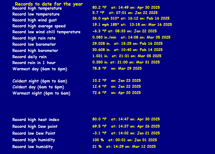
Rainfall To date this year
15.920 in. (404.4 mm)
Maximum rain per minute (last hour)
0.000 in/min
Maximum rain per hour (last 6 hours)
0.000 in/hour
Yesterdays rainfall
0.000 in
DewPoint
66.6°F (Wet Bulb :71.4°F )
Humidity
63 %, Humidex 92.9°F
Barometer corrected to msl
29.804 in. (1009.3 hPa)
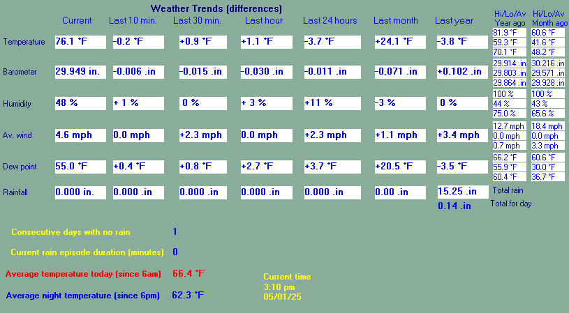
Pressure change
0.00 in. (last hour)
Trend (last hour)
STEADY
Pressure change (last 12 hours)
-0.09 in
Pressure change (last 6 hours)
-0.09 in
Current Indoor Temp. 70.2°F
Current Indoor Hum. 43%
This page is updated from recent data collected by a DAVIS VANTAGE PRO weather station Use the Reload or Refresh facility on your browser to retrieve the latest data.